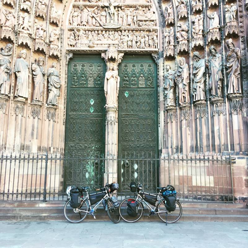
From camping Strasbourg we cycle into the old center with the special cathedral of which there is only one tower instead of two. On Sunday mornings it is quiet in the streets where surprising rivers and brooks flow through in different places. Via a modern white slow traffic bridge we cross the Rhine and enter Germany again.

We follow a route called Kinzigtal Radroute. If you want to cross the Black Forest by bike, we can wholeheartedly recommend this route. Along the river Kinzig it is nice and easy to cycle and you come a long way in the Schwarzwald without having to seriously climb. Thanks to the wind from a sloping gradient rate averaged 20 km / h. Surprisingly beautiful on this route is the town of Wolfach, a jewel in the Schwarzwald. We continue to follow the Kinzig to the village of Schiltach, where we follow a river with the same name. At Schiltach is a nice campsite with no more than 40 camping spots, a good restaurant and friendly owners who have been driving this campsite for over 30 years. Here we store our tent. We had taken our food from France, because in Germany Sunday rest is strictly observed and all shops are closed. We drink a nice local beer at the restaurant of the campsite, after which we prepare a nice pan of ravioli for us (recipe: one can of ready-to-eat ravioli and this "digest" with an onion, paprika, a chorizo sausage and some cayenne pepper).

The next morning we cycle a few kilometers through the valley of the Schiltach stream: it continues to cycle nicely with hardly any height gain and wind in the back. It seems like we can cross the whole Schwarzwald via a valley, but that is of course not possible. From the town of Schramberg there must be a lot of climbing over a busy road with lots of freight traffic. In our route we included a shortcut that we are pretty sure is not bicycling. The alternative, busy motorway is fortunate enough. After a kilometer or 5 we are up and leave the Schwarzwald behind us. There is no real decline, we have reached the Swabian country and remain at height.
Our goal today is Tuttlingen, which lies on the Danube on the edge of the southern Swabian Albs. Before we can descend to the valley of the (still "young") Danube, we climb to the official European watershed at
693 m altitude, between the basins of the Rhine and the Danube.
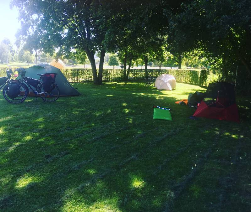
Tuttlingen is a nice, lively town, but more important: they have a camping spot for (only) cyclists! Camping is free and you do not have to register or register anywhere. There are public toilets near the tent area; we are in Germany, so these are generally clean. If you want to use the neat shower rooms and non-public toilets, you can get a key at TuWass pool for € 5 per person, couple or group! This is awesome! This should be followed in more places! We are already early (around 3 pm) on this camping spot. There is no one and we are looking for the best place. We hope that more cyclists will come. That wish comes true, because late in the afternoon the field is half full with eventually 10 cyclists, successively: a German, a Canadian, a Belgian, an English and four Frenchmen (and we two Dutch people, haha).

The next day we have to unpack our packed and contracted tent for the second consecutive time because Roelie's iphone is still there. Yesterday we had agreed that the person who leaves something in the tent when it is packed must undergo an appropriate "punishment". In this case, Roelie had to surrender the 4 empty cans of beer - in Germany € 1 to deposit money - to the men's walhalla: the Getränkehalle.
From Tuttlingen we immediately start with a steep climb about 7 km from the Danube valley into the Swabian Albs. Once upstairs we are treated to a great view! We even see Lake Constance, more than 20 km to the south. What follows is a great descent through a beautiful nature reserve. Despite our speed we see a fox, an owl and two deer along the way.
At the end of the long descent we cycle from Eigeltingen to the last stretch towards Bodensee. We leave the planned route at the village Wahlwies. This would then take us directly to Switzerland, to then follow the southern shore of Lake Constance towards Austria. However, we choose to follow the German north bank, to avoid an overnight stay in the expensive Switzerland.
It turns out to be a busiest route. We had expected that too. We cycle through a beautiful village called Meersburg and from there the villages are joined together. The villages consist of hotels, campsites, restaurants, pension inns, guesthouses, Biergartens, shops and very occasionally there is a house or farm between them.
From Tuttlingen we immediately start with a steep climb about 7 km from the Danube valley into the Swabian Albs. Once upstairs we are treated to a great view! We even see Lake Constance, more than 20 km to the south. What follows is a great descent through a beautiful nature reserve. Despite our speed we see a fox, an owl and two deer along the way.
At the end of the long descent we cycle from Eigeltingen to the last stretch towards Bodensee. We leave the planned route at the village Wahlwies. This would then take us directly to Switzerland, to then follow the southern shore of Lake Constance towards Austria. However, we choose to follow the German north bank, to avoid an overnight stay in the expensive Switzerland.
It turns out to be a busiest route. We had expected that too. We cycle through a beautiful village called Meersburg and from there the villages are joined together. The villages consist of hotels, campsites, restaurants, pension inns, guesthouses, Biergartens, shops and very occasionally there is a house or farm between them. For us much and much too touristy and too crowded. From the big city of Friedrichshaven, halfway the Lake Constance (Bodensee), to the very end in Austria (Bregenz), we no longer see the lake from the bike path. Very occasionally we still have a glimpse of it and the color has become more turquoise, because the heavy clouds open somewhat.
We are looking for a campsite. At 20 km east of Friedrichshafen near the village of Kressbron there are three bike-friendly campsites within a stone's throw of each other, so the map of the tourist information lets us know. We cycle to camping Gohren and look forward to a spot on a field along Lake Constance. However, the campsite is mega-sized and the field for tents is separate and far away from everything, including Lake Constance. The advantage is that you do not have the impression that you are on a campsite with> 1000 pitches. The tent field is nice and messy. According to the map of the campsite it would be neatly divided into 100 spots, but there is nothing to see. We estimate that each tent occupies around 3 places. Under the apple trees we find a nice spot at the end of the field and put the tent on platz 98/99/100.
After dinner we go to a restaurant where on a big screen the World Cup football match France-Belgium is shown. We are still in time to watch the exciting half. There is no Belgian in the public. At the end of the race we grieve for our Belgian neighbors: we had it so for them!
The next day we cycle towards Austria, to Bregenz and then into the Alps (more about this in our next blog). Before we realize it, we see that the bicycle signs have changed; are we already in Austria? After a few kilometers a large sign with Vorarlbergerop gives clarity. Goodbye Germany, from now on it is Voralbergen.


